Activity Overview: Natural resources are not evenly distributed across the United States or even across the State of Texas. Looking at the horizon you can see if you are near the sea or surrounded by timber, but other resources crucial to our daily lives are less obvious. Each of the activities on this page references a different resource and provides resources your class can use to identify different sources of freshwater, fossil fuels, and renewable resources.
Time: This activity is part of a series on maps of natural resources. Each one takes about 15 minutes. You can schedule them in series or you can evaluate them as you discuss each resource in your class.
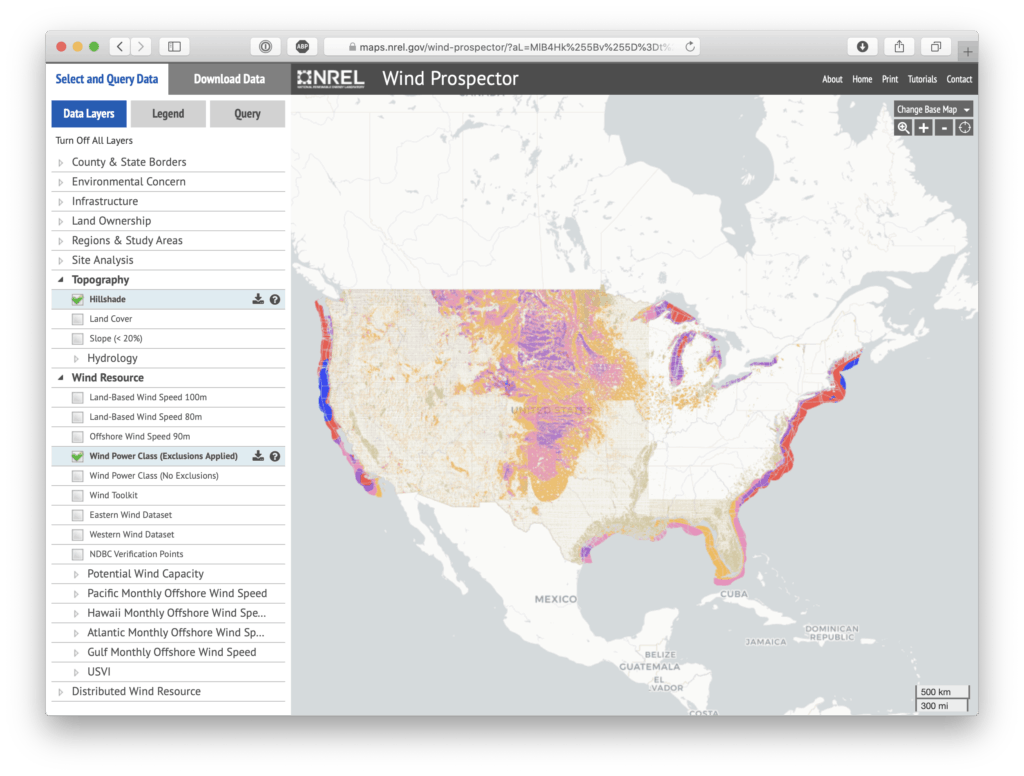
In the United States, wind resources vary greatly. Several geographic pockets have much higher and more profitable wind speeds. The wind corridor of the United States extends from North Dakota south to Texas, where winds blow reasonably fast, and the land is flat and relatively affordable, a compelling combination for the construction of wind farms. In fact, the U.S. corridor ranks as one of the greatest landed wind resources in the world. The Great Lakes and the Appalachian Mountains also experience high wind speeds. The country’s highest wind speeds skim across the ridges of the Rocky Mountains, but their isolation makes these sites economically unviable. Wind blows not only on the continent but also over the oceans, especially near the coast. Coastal and offshore wind resources within a few miles of land are relatively accessible to the major cities located near the ocean.
The National Renewable Energy Laboratory collected information about wind speed from across the United States and offshore coastal areas during the compilation of the Renewable Electricity Futures Study. The geographic areas divided up by wind class are available in the Wind Prospector Map.
Change the map view from Data Layers to Legend by using the buttons at the top of the left column of the Select and Query Data Options. You can also investigate a specific point or a region by using the Query button.
Ask students to answer the following questions:
TEKS
SS.6.6B, SS.6.3C

We'd love to help answer any questions and help you get started! Drop us a line and we'll get back to you as soon as we can.
Watt Watchers of Texas
204 E. Dean Keeton Street, Austin, Texas 78712
contact@watt-watchers.com
Nos encantaría contestarle cualquier pregunta que tenga y ayudarle empezar! Envíenos un mensaje y nos pondremos en contacto con usted lo antes posible.
Watt Watchers de Texas
204 E. Dean Keeton Street, Austin, Texas 78712
contact@watt-watchers.com